File list
From NST Wiki
Jump to navigationJump to searchThis special page shows all uploaded files.
| Date | Name | Thumbnail | Size | User | Description | Versions |
|---|---|---|---|---|---|---|
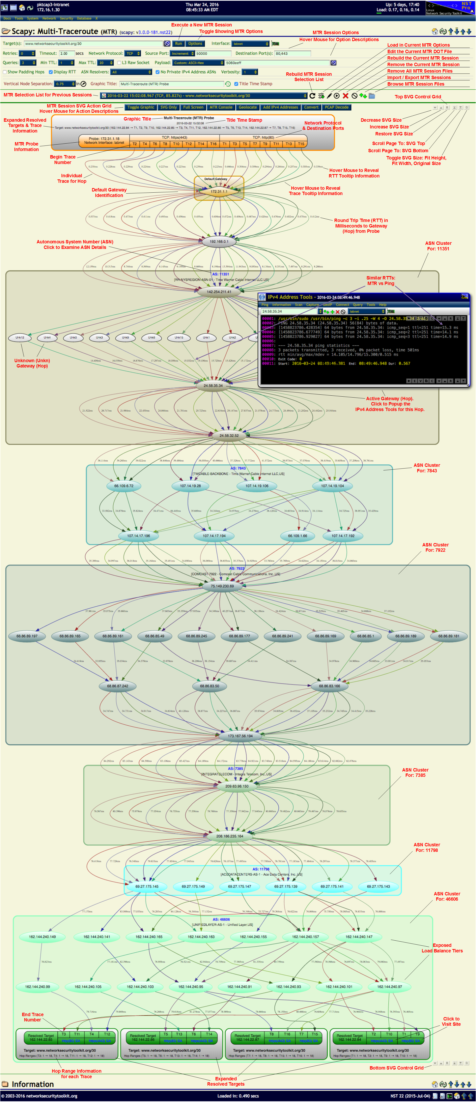
| 08:11, 25 March 2016 | Mrt ref doc.png (file) |  |
3.93 MB | Rwh | Scapy: Multi-Traceroute (MTR) Reference Document. | 1 |
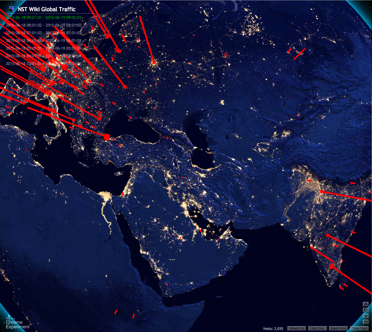
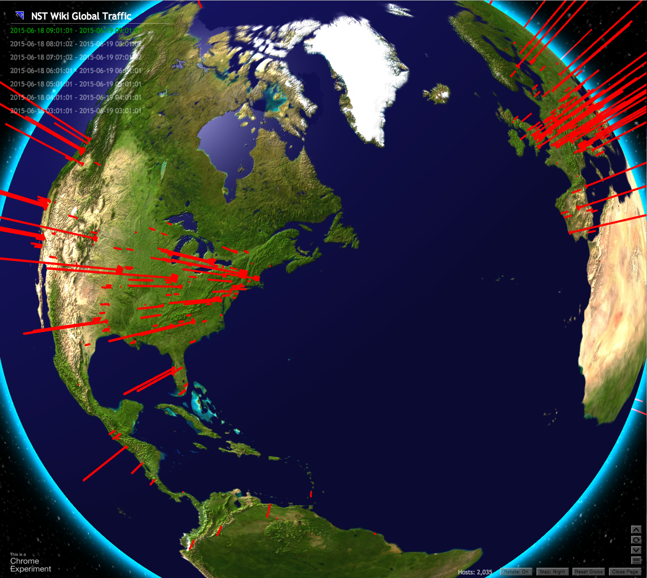
| 10:08, 19 June 2015 | Nstwikiwebglglobenight.png (file) |  |
2.29 MB | Rwh | NST Wiki Traffic (Night Time) - NST WebGL Globe implementation. | 1 |
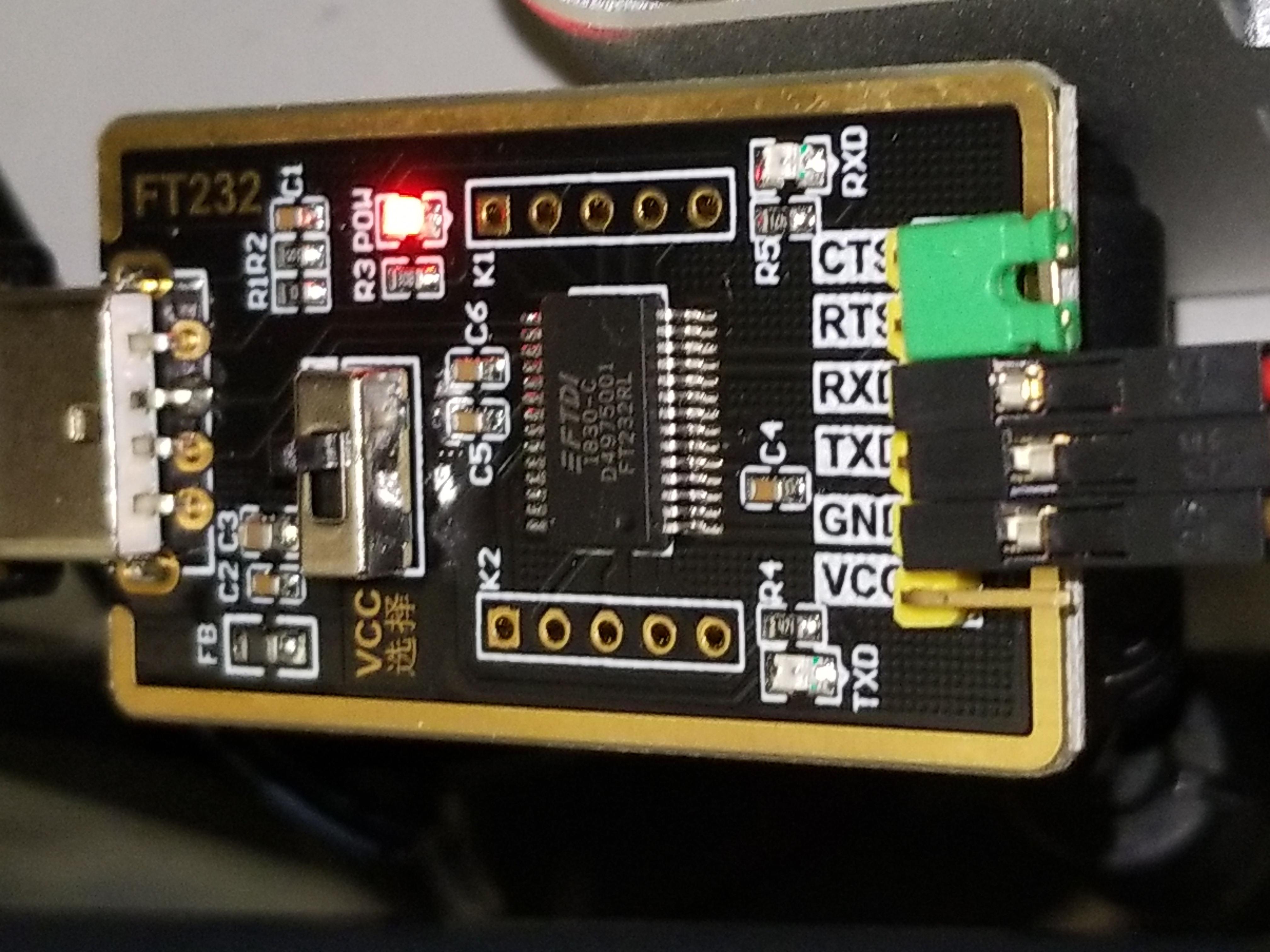
| 13:17, 18 February 2021 | FT232RL.jpg (file) |  |
2.24 MB | Rwh | FT232RL USB Serial Adapter | 1 |
| 10:44, 27 September 2011 | Ethernet pause frame decode.png (file) |  |
1.96 MB | Rwh | Ethernet Flow Control Pause Frame Decode. | 1 |
| 07:43, 2 October 2012 | Toolsmith-nst.pdf (file) |  |
1.9 MB | Rwh | Oct: 2012 Article by Russ McRee - NST: Packet Analysis Personified. | 1 |
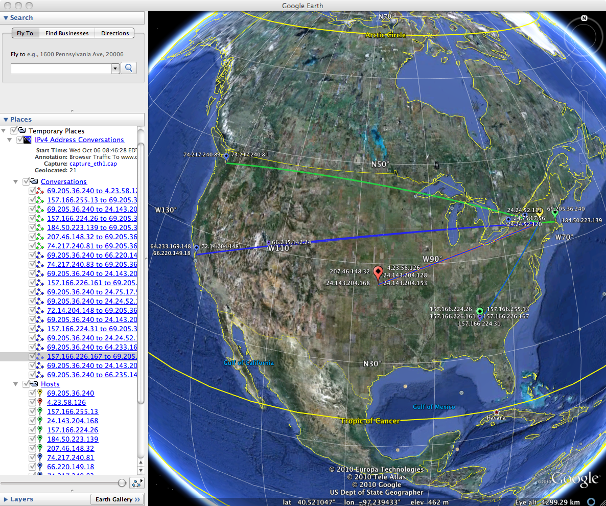
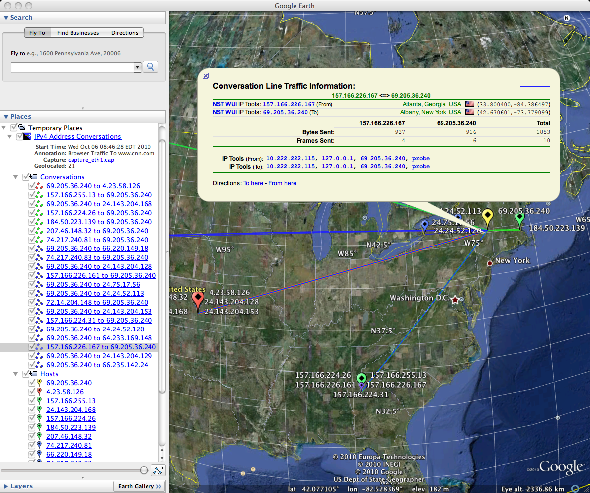
| 09:34, 15 October 2010 | Conversations kml.png (file) |  |
1.87 MB | Rwh | IPv4 Address Conversations - KML Document | 1 |
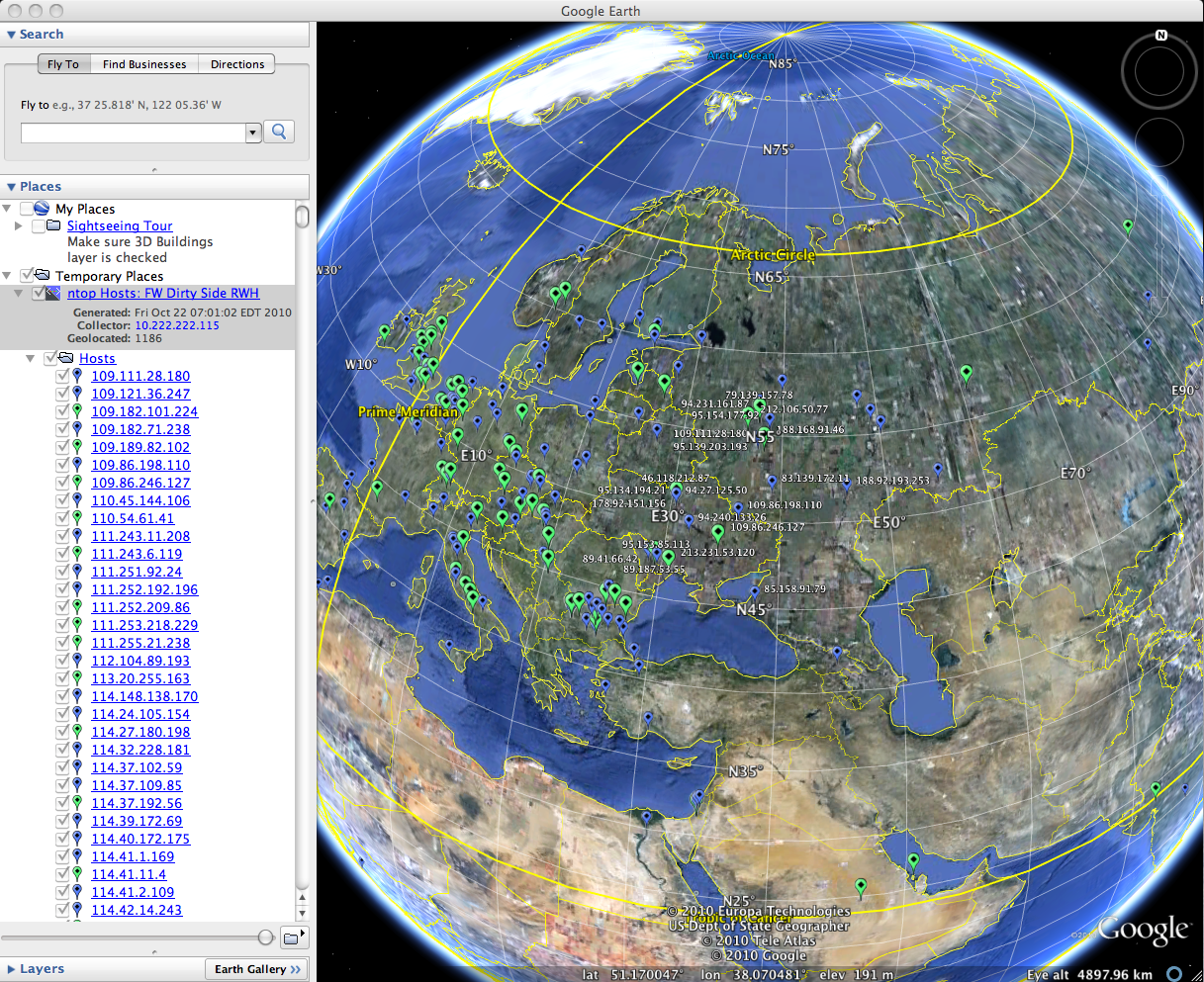
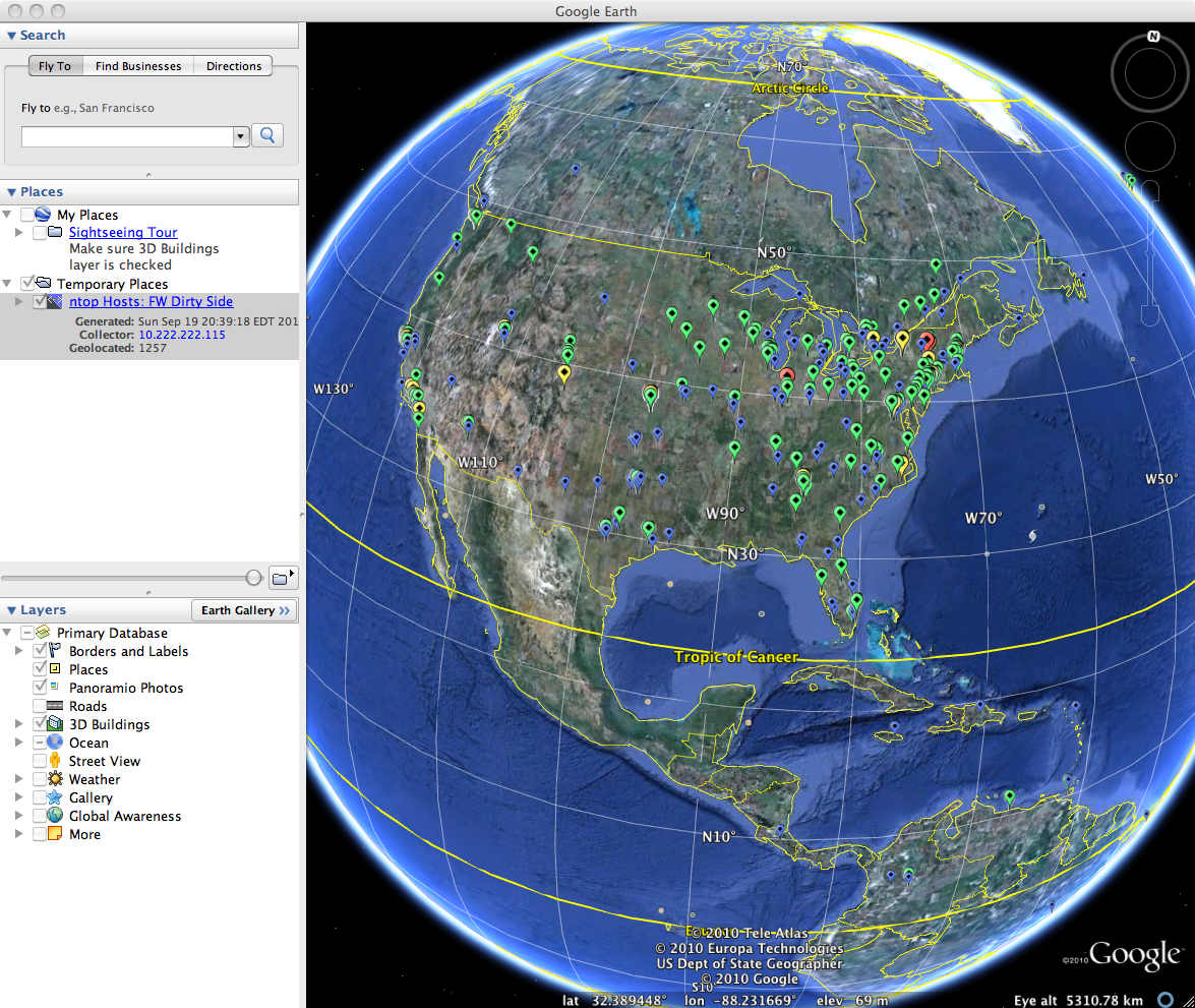
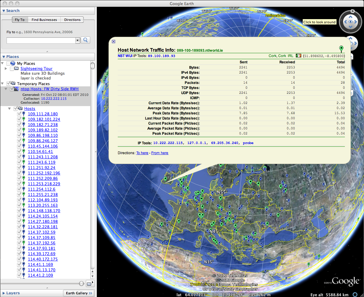
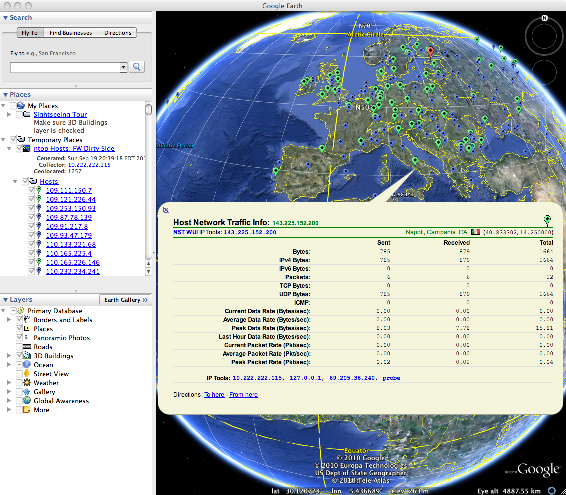
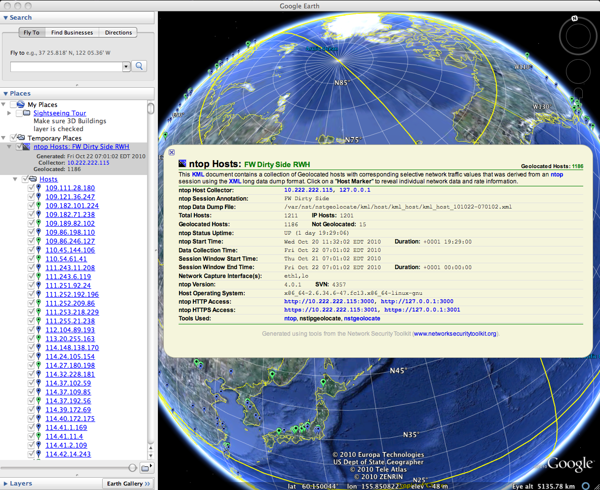
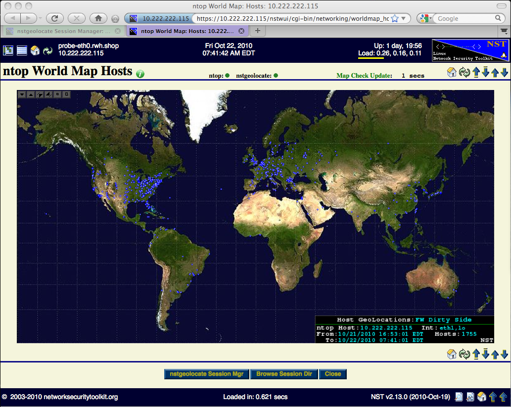
| 08:39, 22 October 2010 | Nstgeolocate ntop kml hosts.png (file) |  |
1.72 MB | Rwh | nstgeolocate KML ntop Hosts Monitor... | 1 |
| 20:55, 19 September 2010 | Ntop-ge.png (file) |  |
1.6 MB | Rwh | ntop Google Earth - no description | 1 |
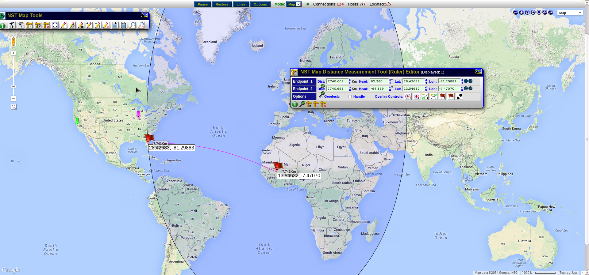
| 16:23, 16 December 2014 | Ruler.png (file) |  |
1.54 MB | Aryker | An example of a ruler in use. | 1 |
| 16:32, 16 December 2014 | Latitude.png (file) |  |
1.46 MB | Aryker | The latitude/longitude grid overlay in use on an NST WUI map. | 1 |
| 16:31, 16 December 2014 | Measurement window in use.png (file) |  |
1.44 MB | Aryker | 1 | |
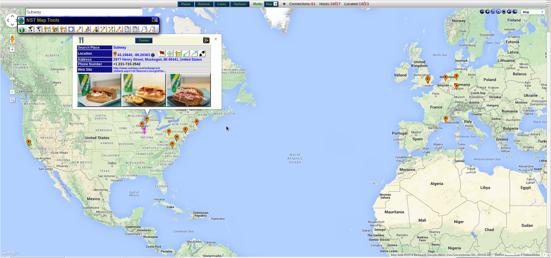
| 19:52, 16 December 2014 | Search bar.png (file) |  |
1.44 MB | Aryker | 1 | |
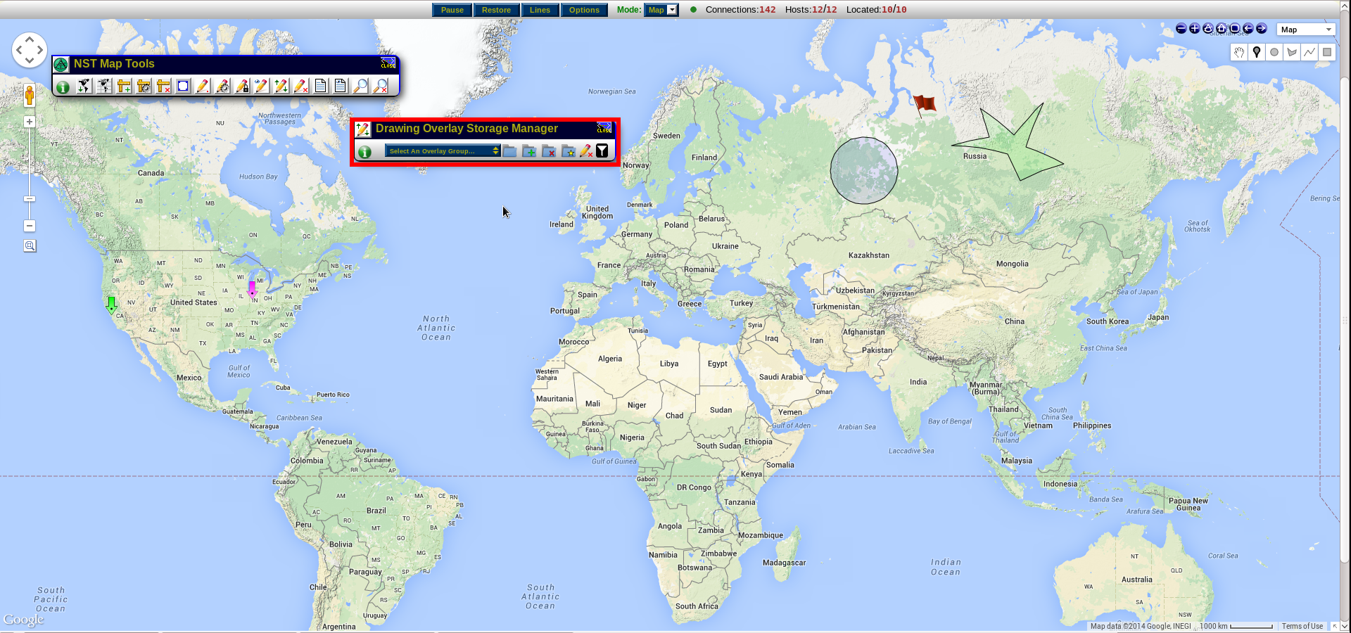
| 17:25, 16 December 2014 | Storage manager.png (file) |  |
1.41 MB | Aryker | 1 | |
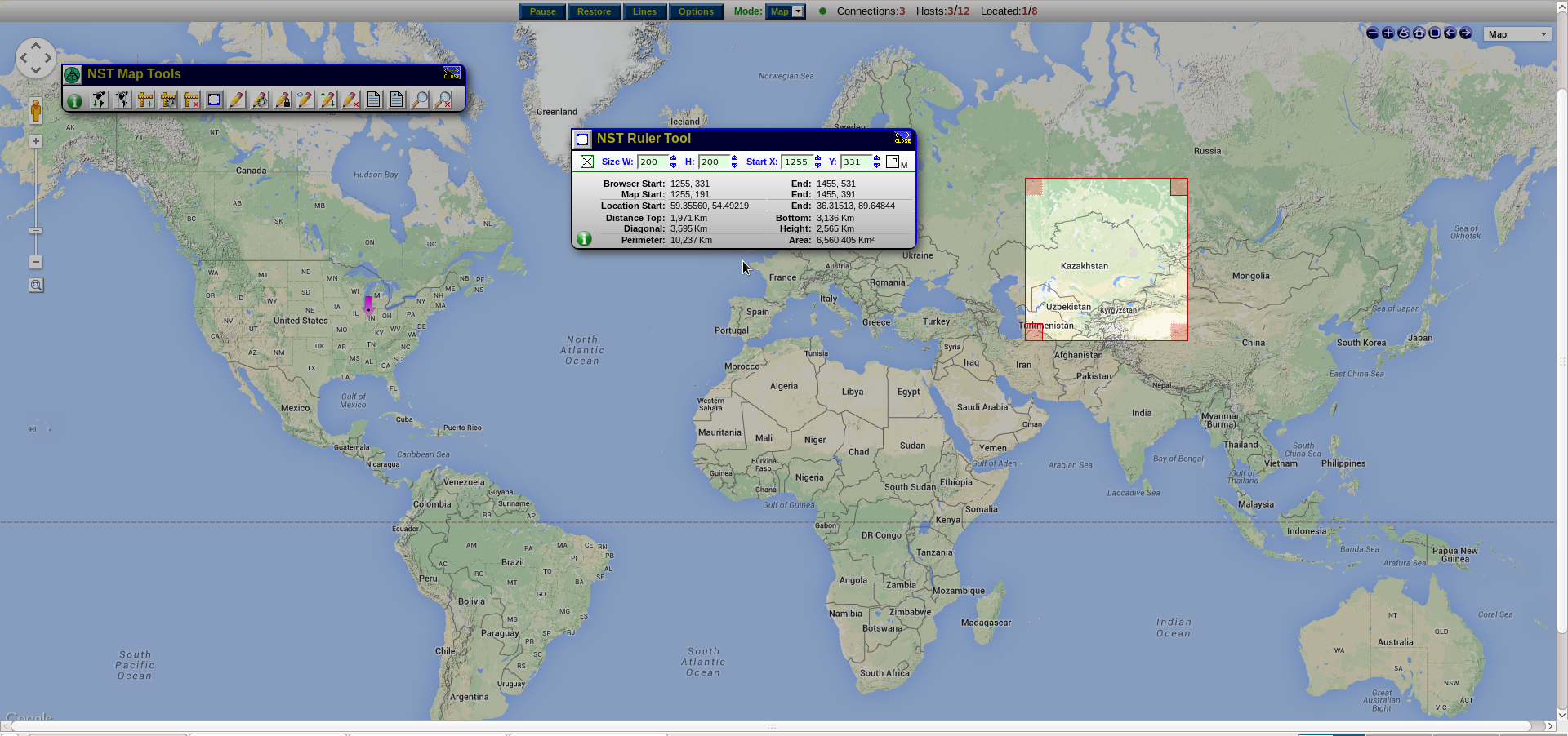
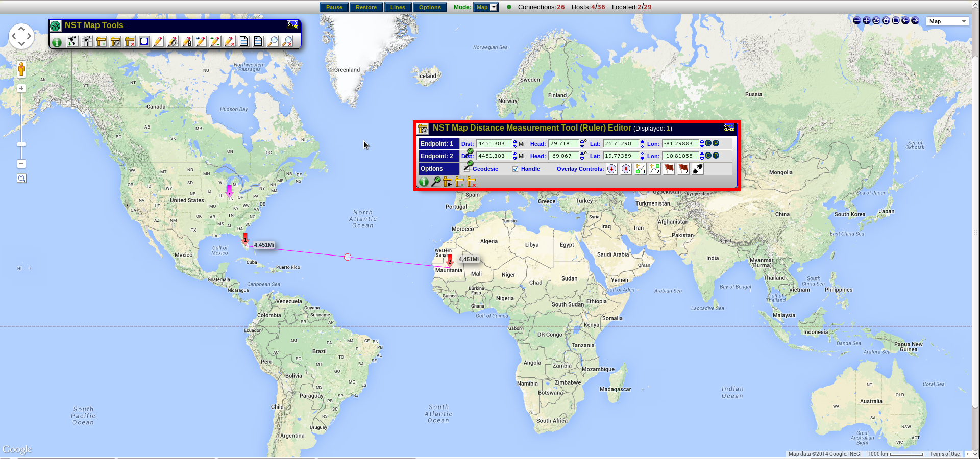
| 16:22, 16 December 2014 | Ruler tool.png (file) |  |
1.41 MB | Aryker | An example of the NST Ruler tool in use. | 1 |
| 10:07, 19 June 2015 | Nstwikiwebglglobe.png (file) |  |
1.39 MB | Rwh | NST Wiki Traffic (Day Time) - NST WebGL Globe implementation. | 1 |
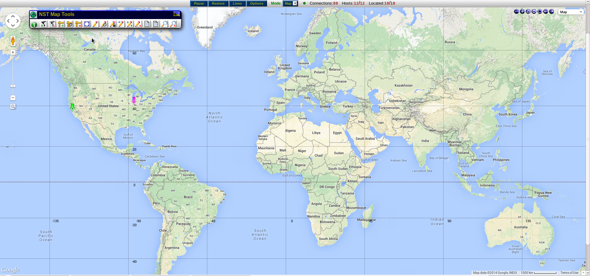
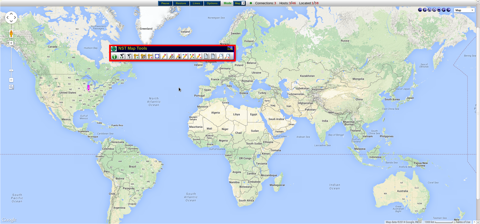
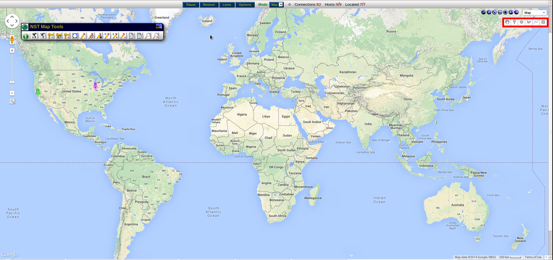
| 16:27, 16 December 2014 | Nst mapping toolbar.png (file) |  |
1.37 MB | Aryker | The NST Mapping toolbar overlaid onto a map within the NST WUI. | 1 |
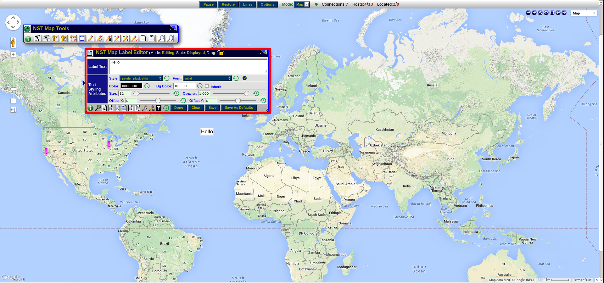
| 19:53, 16 December 2014 | Label editor.png (file) |  |
1.37 MB | Aryker | 1 | |
| 16:31, 16 December 2014 | Measurement window.png (file) |  |
1.31 MB | Aryker | 1 | |
| 16:33, 16 December 2014 | Google overlay toolbar.png (file) |  |
1.25 MB | Aryker | The Google Map Drawing Manager Widget enabled on an NST WUI map. | 1 |
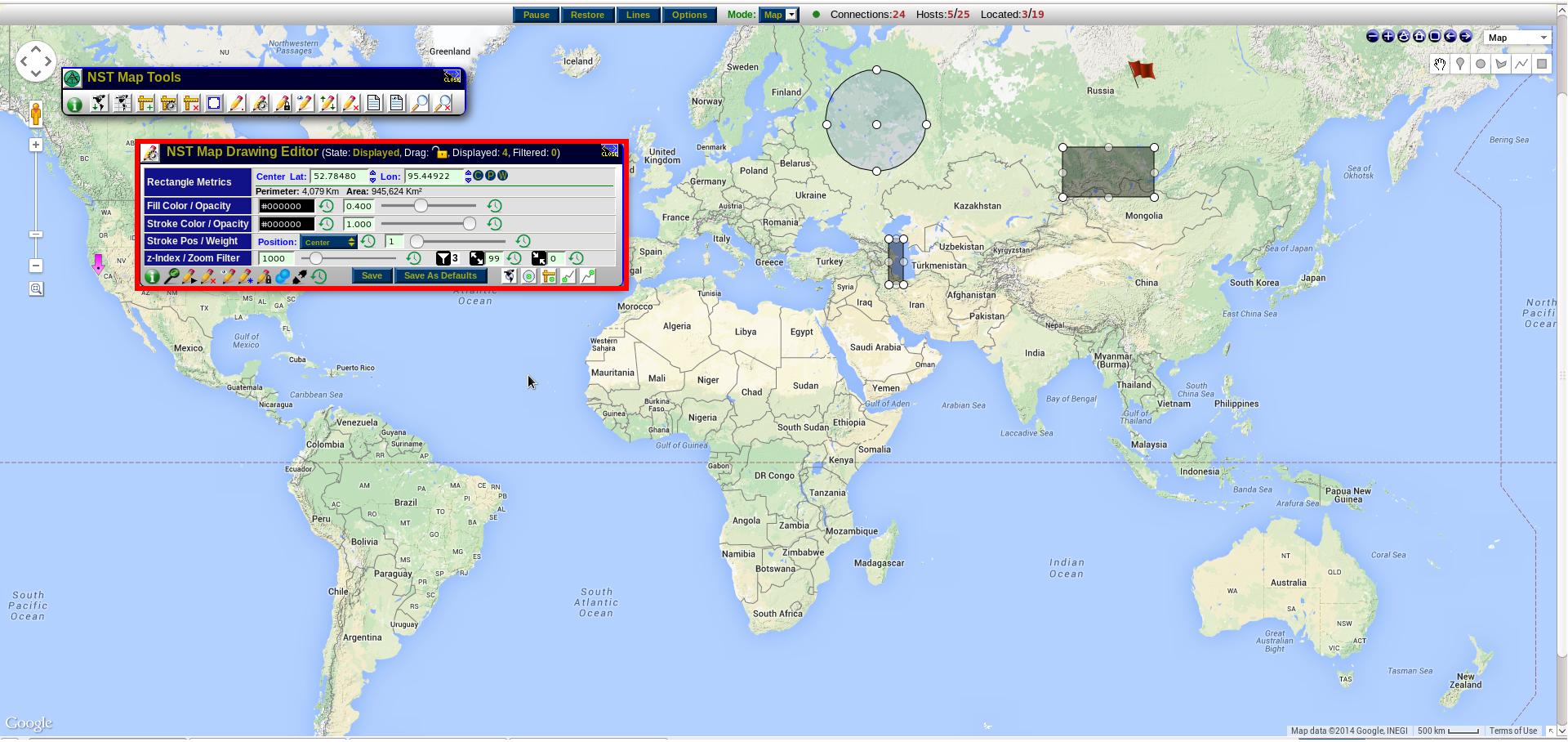
| 17:26, 16 December 2014 | Map drawing editor.png (file) |  |
1.21 MB | Aryker | The NST Map Drawing Editor. | 1 |
| 09:35, 15 October 2010 | Conversations kml zoom tt.png (file) |  |
1.2 MB | Rwh | IPv4 Address Conversations - KML Document - Zoomed in with Conversation Tool Tip | 1 |
| 15:37, 15 February 2011 | SPAN-Out-of-the-Box-by-John-He.pdf (file) |  |
1.14 MB | Rwh | Dualcomm Article on TAP vs SPAN by John He... | 1 |
| 16:29, 16 December 2014 | Nst map icon.png (file) | 1.12 MB | Aryker | The location of the NST mapping tools icon. | 1 | |
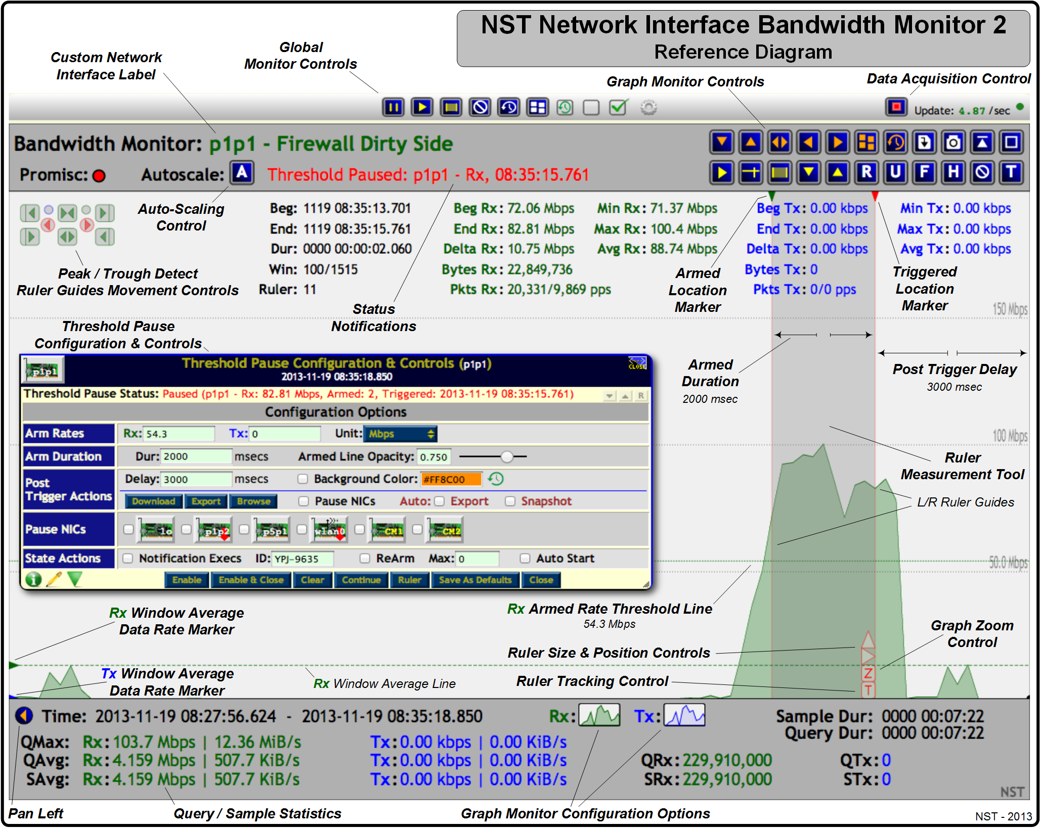
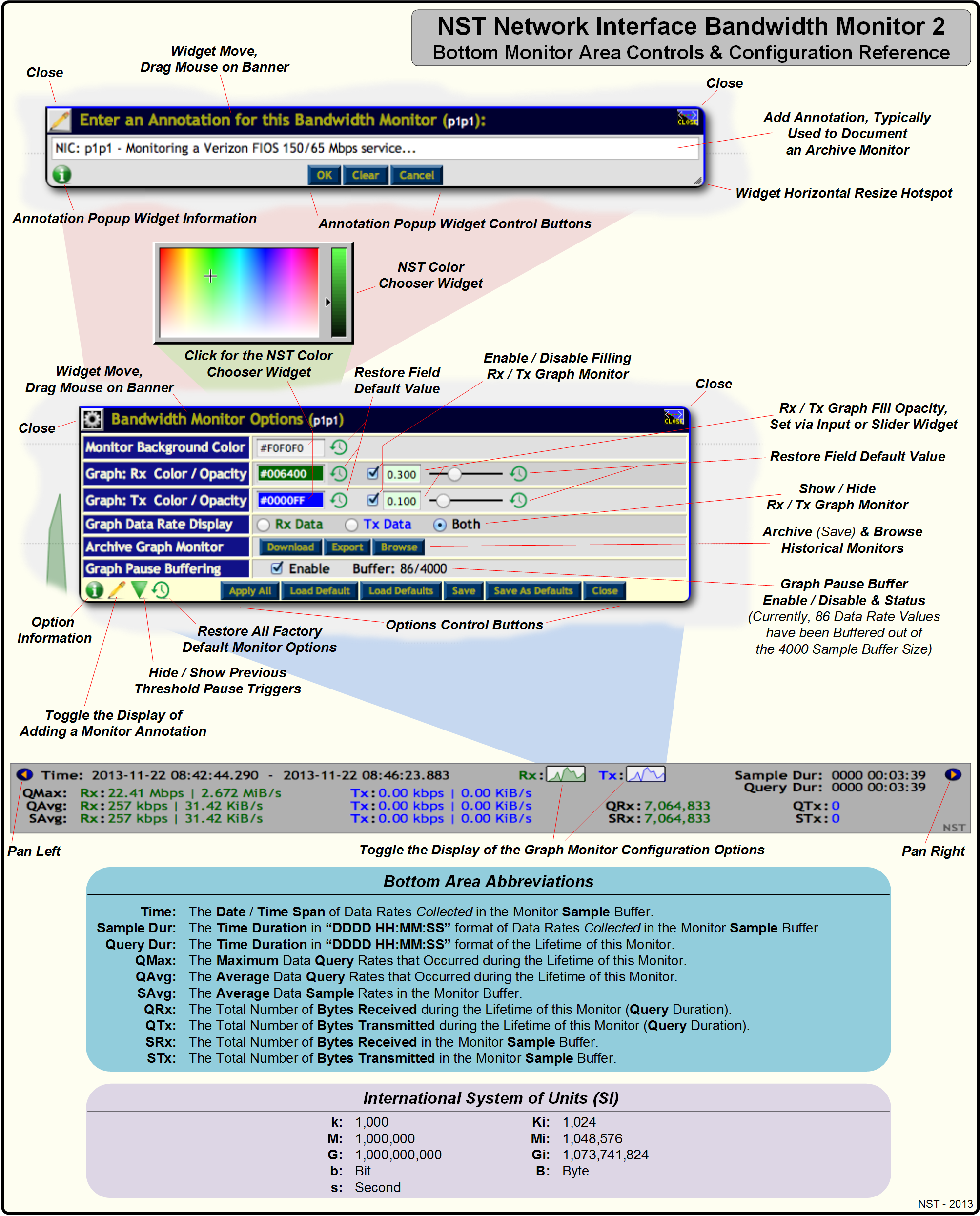
| 10:49, 22 November 2013 | Bwmon2 ref 1.png (file) |  |
1.11 MB | Rwh | NST Network Interface Bandwidth Monitor 2 - Reference Diagram. | 1 |
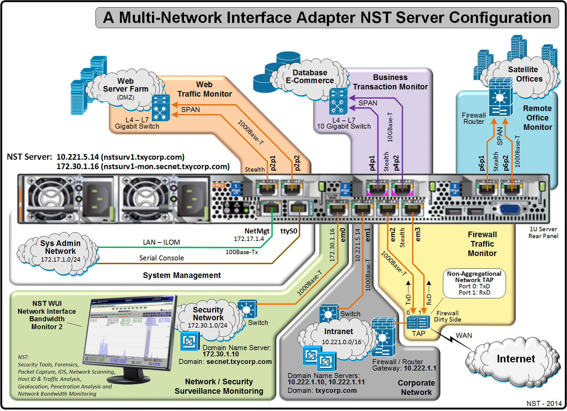
| 07:28, 1 April 2014 | Nstnetcfgserver.png (file) |  |
1.05 MB | Rwh | A Multi-Network Interface Adapter NST Server Configuration. | 1 |
| 08:41, 22 October 2010 | Nstgeolocate ntop kml hosts host info.png (file) |  |
1.02 MB | Rwh | nstgeolocate KML ntop Hosts Monitor with Host Balloon... | 1 |
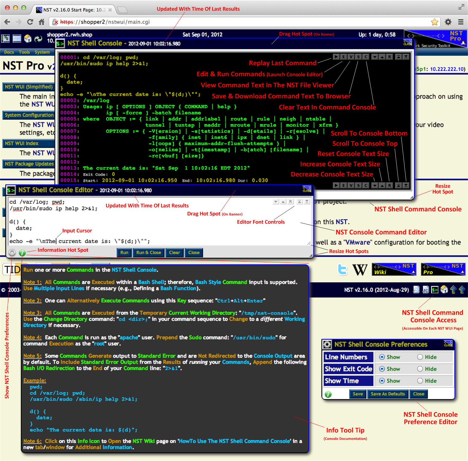
| 06:00, 12 September 2012 | Nstshellcmdconsole1.png (file) |  |
1 MB | Rwh | NST Shell Command Console Reference Diagram. | 1 |
| 09:36, 15 October 2010 | Conversations kml filter description.png (file) |  |
1,006 KB | Rwh | IPv4 Address Conversations - KML Document with Display Filter and Description Balloon | 1 |
| 20:57, 19 September 2010 | Ntop-ge-host.png (file) |  |
990 KB | Rwh | ntop Google Earth - Host Description | 1 |
| 08:42, 22 October 2010 | Nstgeolocate ntop kml hosts description.png (file) |  |
989 KB | Rwh | nstgeolocate KML ntop Hosts Monitor with Description Balloon... | 1 |
| 08:53, 26 November 2013 | Bwmon2 bottom area 1.png (file) |  |
981 KB | Rwh | NST Network Interface Bandwidth Monitor 2- Bottom Monitor Area Controls & Configuration. | 1 |
| 09:35, 21 November 2013 | Bwmon2 ar tp 1.png (file) |  |
946 KB | Rwh | NST Network Interface Bandwidth Monitor 2 - Archive & Threshold Pause Snapshots. | 1 |
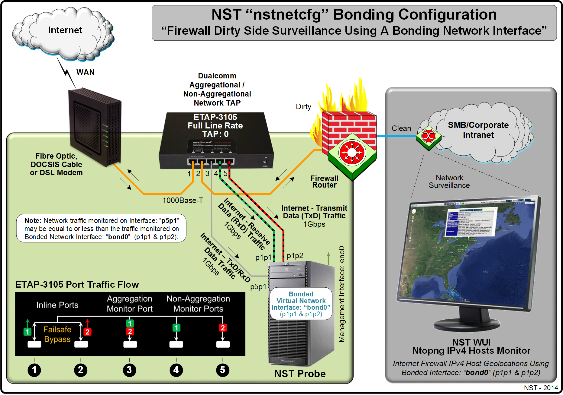
| 22:14, 31 March 2014 | Nstnetcfgbonding.png (file) |  |
916 KB | Rwh | NST nstnetcfg Bonding Configuration with Monitoring. | 1 |
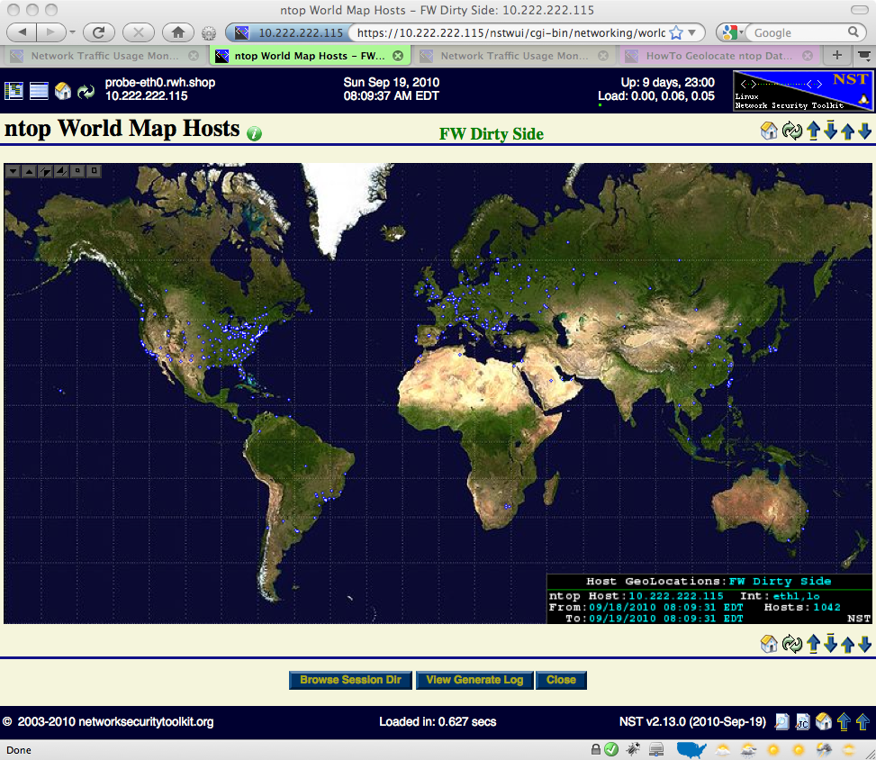
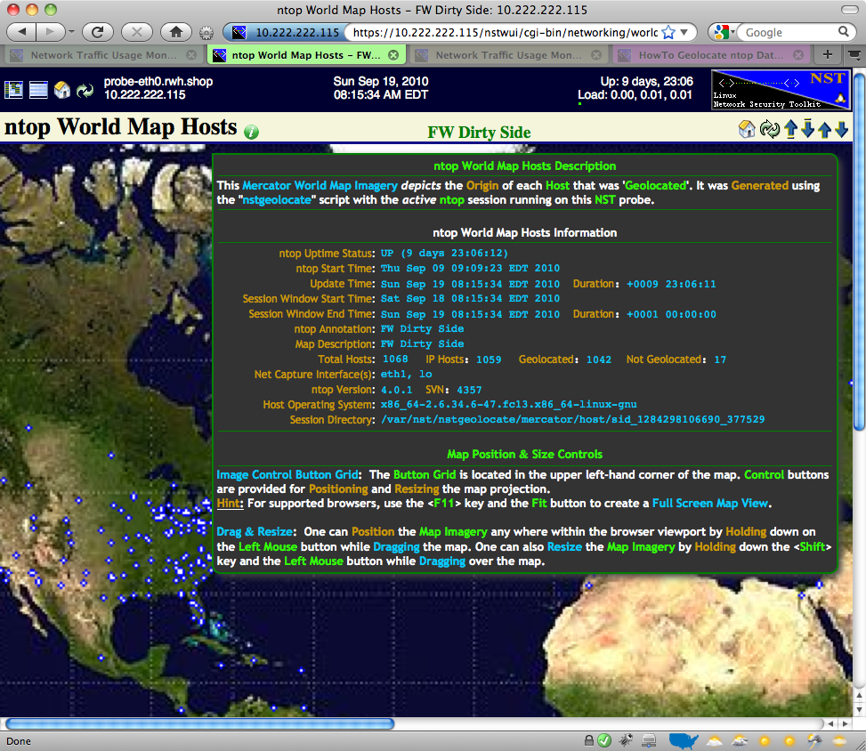
| 08:19, 19 September 2010 | Ntop-wm-hosts.png (file) |  |
884 KB | Rwh | World Map Hosts example - corrected DOM tooltip spelling... | 1 |
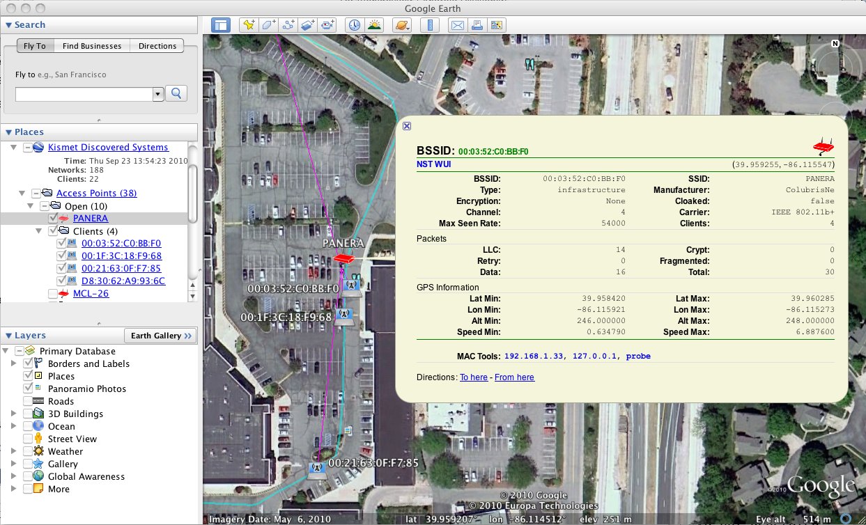
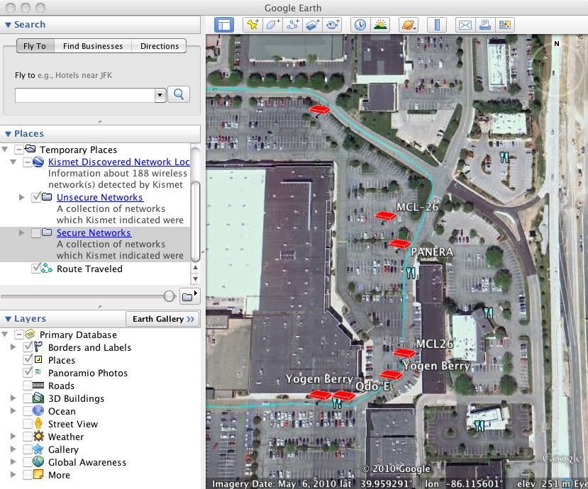
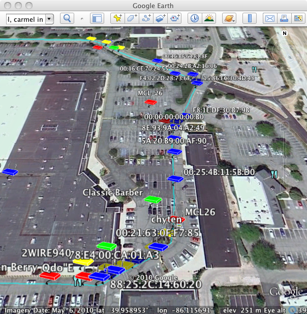
| 16:13, 28 October 2010 | Kismet-google-earth-clients.png (file) |  |
872 KB | Paul Blankenbaker | Clients connected to the PANERA network in the 2010-Oct-27 NST update | 1 |
| 10:23, 29 March 2014 | Nstnetcfgnotebook.png (file) |  |
870 KB | Rwh | A Multi-Network Interface Adapter NST Notebook Configuration. | 1 |
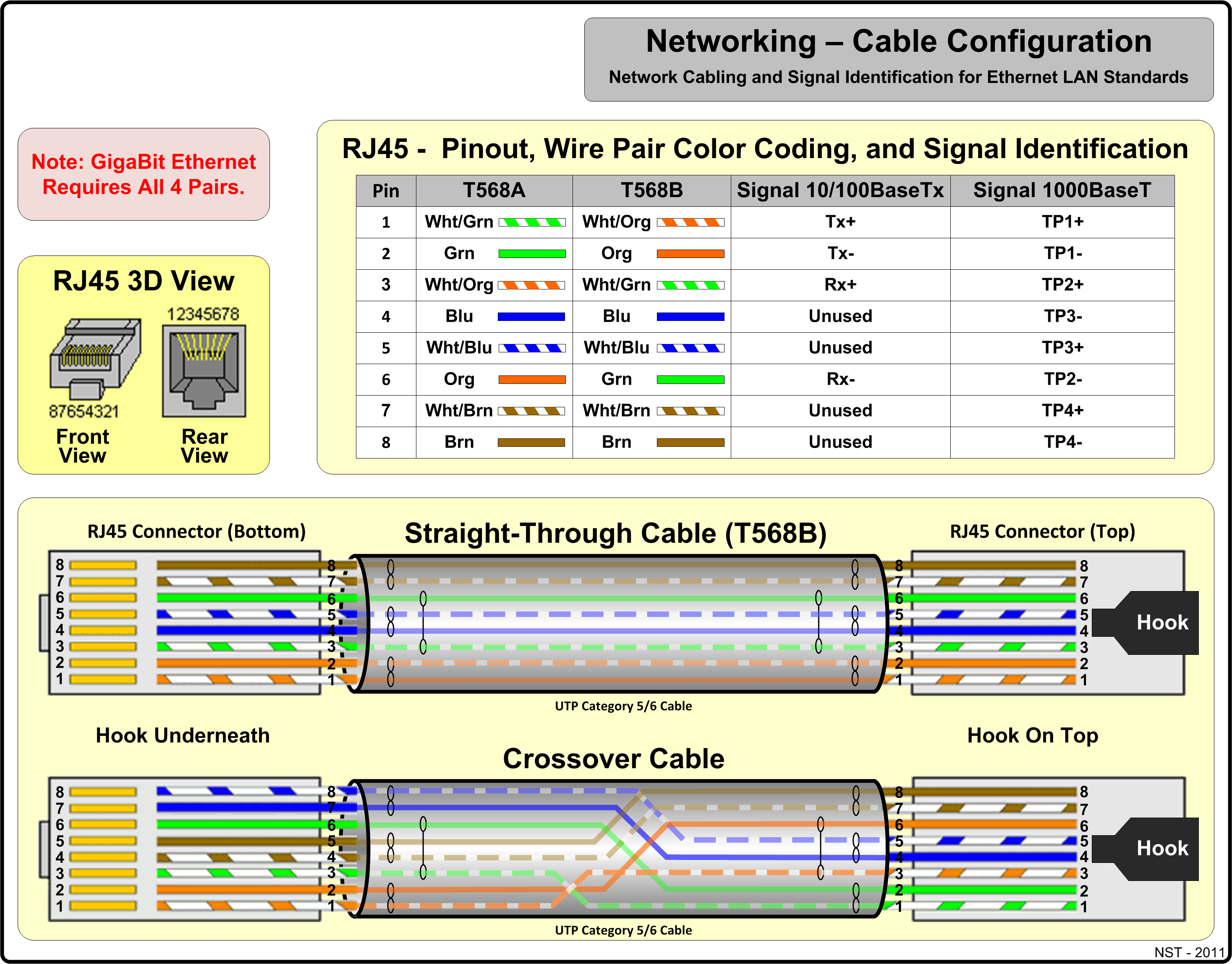
| 10:53, 27 September 2011 | Lan cable.png (file) |  |
867 KB | Rwh | Ethernet LAN cable diagram. | 1 |
| 19:52, 4 May 2011 | Geoip-kml-api.png (file) |  |
860 KB | Paul Blankenbaker | Example of using the nstipgeolocate command to convert a list of IP addresses to a XML file with location information and then applying a XSL template file (which you can customize) to convert the XML file into KML. This image shows the resulting KML file | 1 |
| 08:17, 30 August 2012 | Nstbwmon3.png (file) |  |
853 KB | Rwh | Network Interface Bandwidth Monitor - Reference Diagram. | 1 |
| 15:40, 29 September 2010 | Kismet-google-earth-open.png (file) |  |
795 KB | Paul Blankenbaker | Using Google Earth to only show the open WIFI networks found by Kismet | 1 |
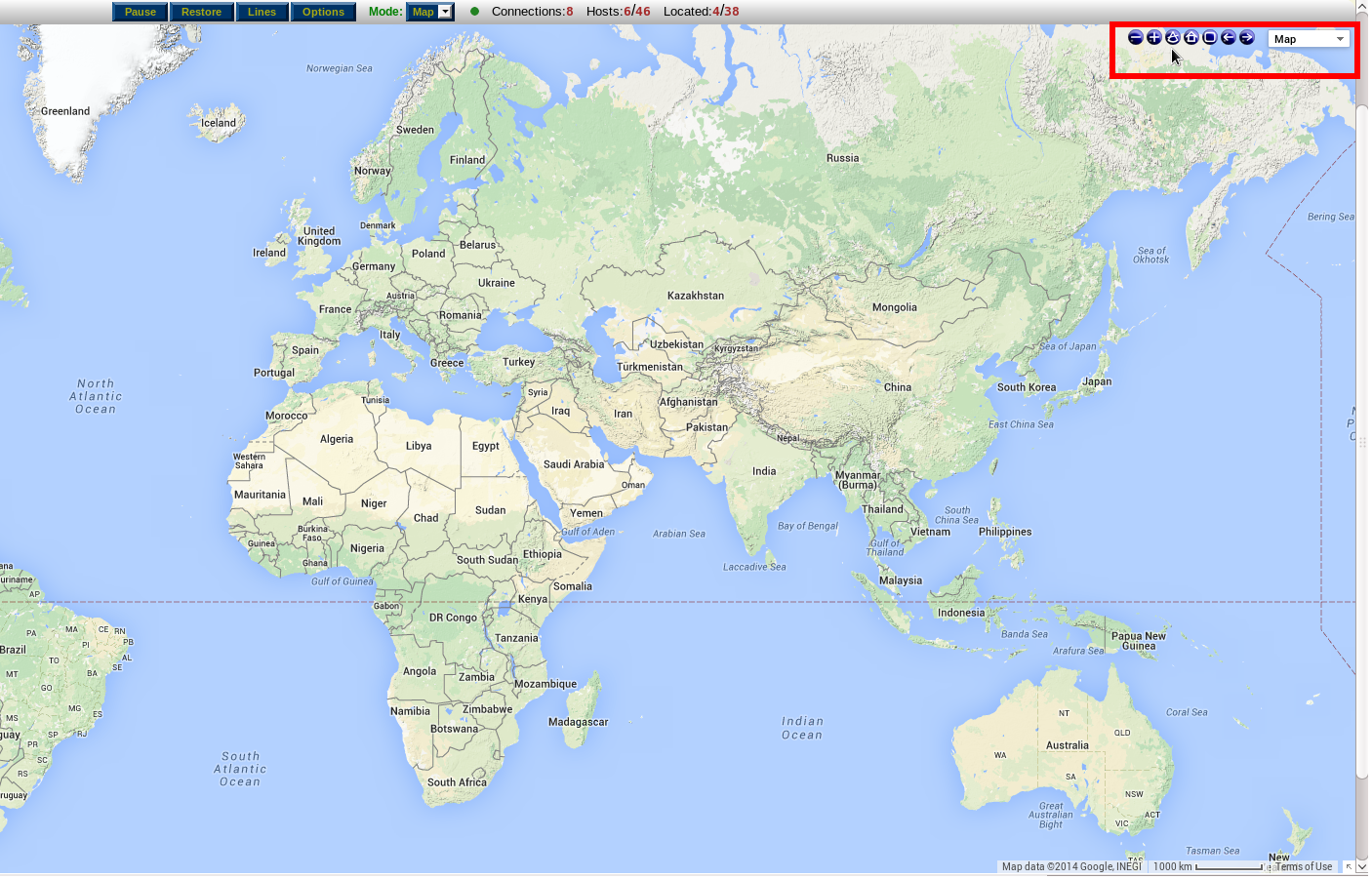
| 08:31, 22 October 2010 | Nstgeolocate ntop wm hosts.png (file) |  |
792 KB | Rwh | nstgeolocate World Map Hosts Monitor... | 1 |
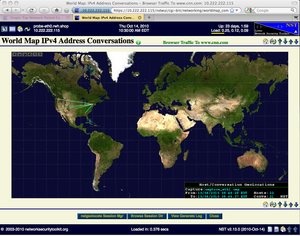
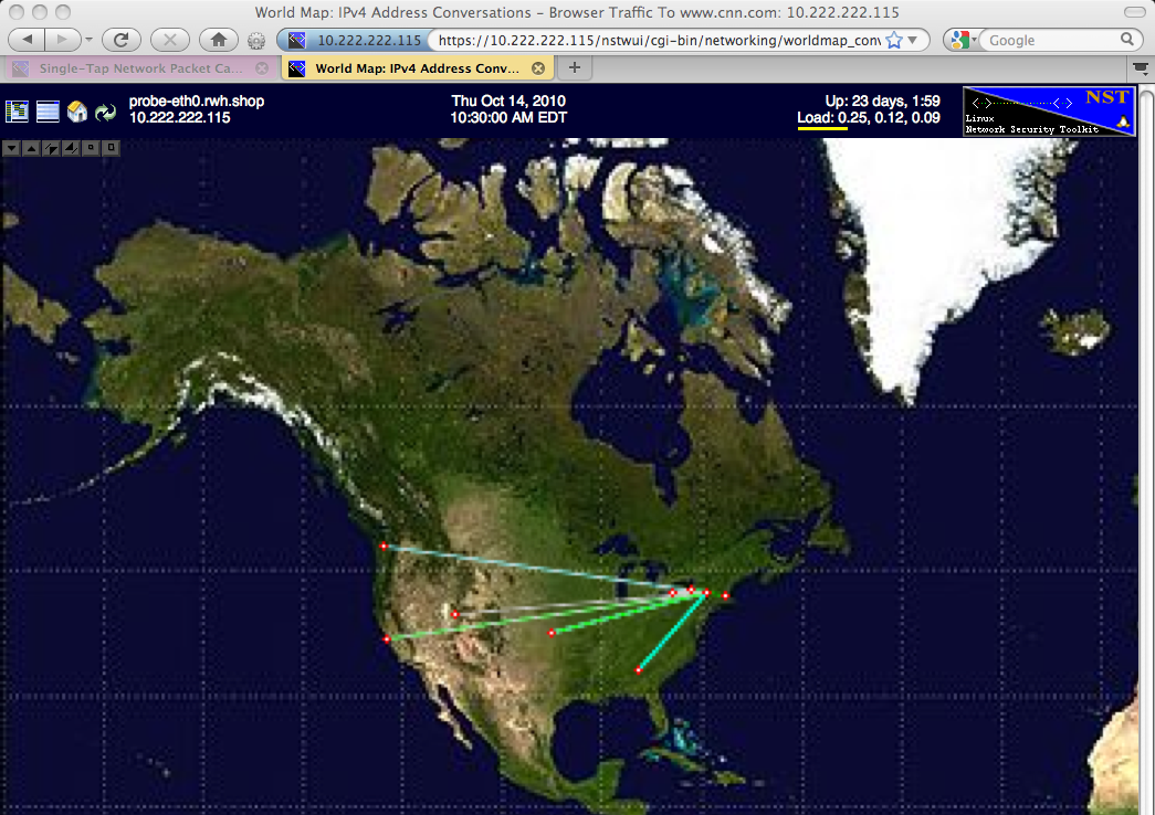
| 10:40, 14 October 2010 | Conversations wm.png (file) |  |
789 KB | Rwh | IPv4 Address Conversations - Mercator World Map... | 1 |
| 20:56, 19 September 2010 | Ntop-ge-description.png (file) |  |
789 KB | Rwh | ntop Google Earth - Description... | 1 |
| 17:00, 23 September 2010 | Kismet-google-earth.png (file) |  |
735 KB | Paul Blankenbaker | Results produced by the kismet service displayed using Google Earth | 1 |
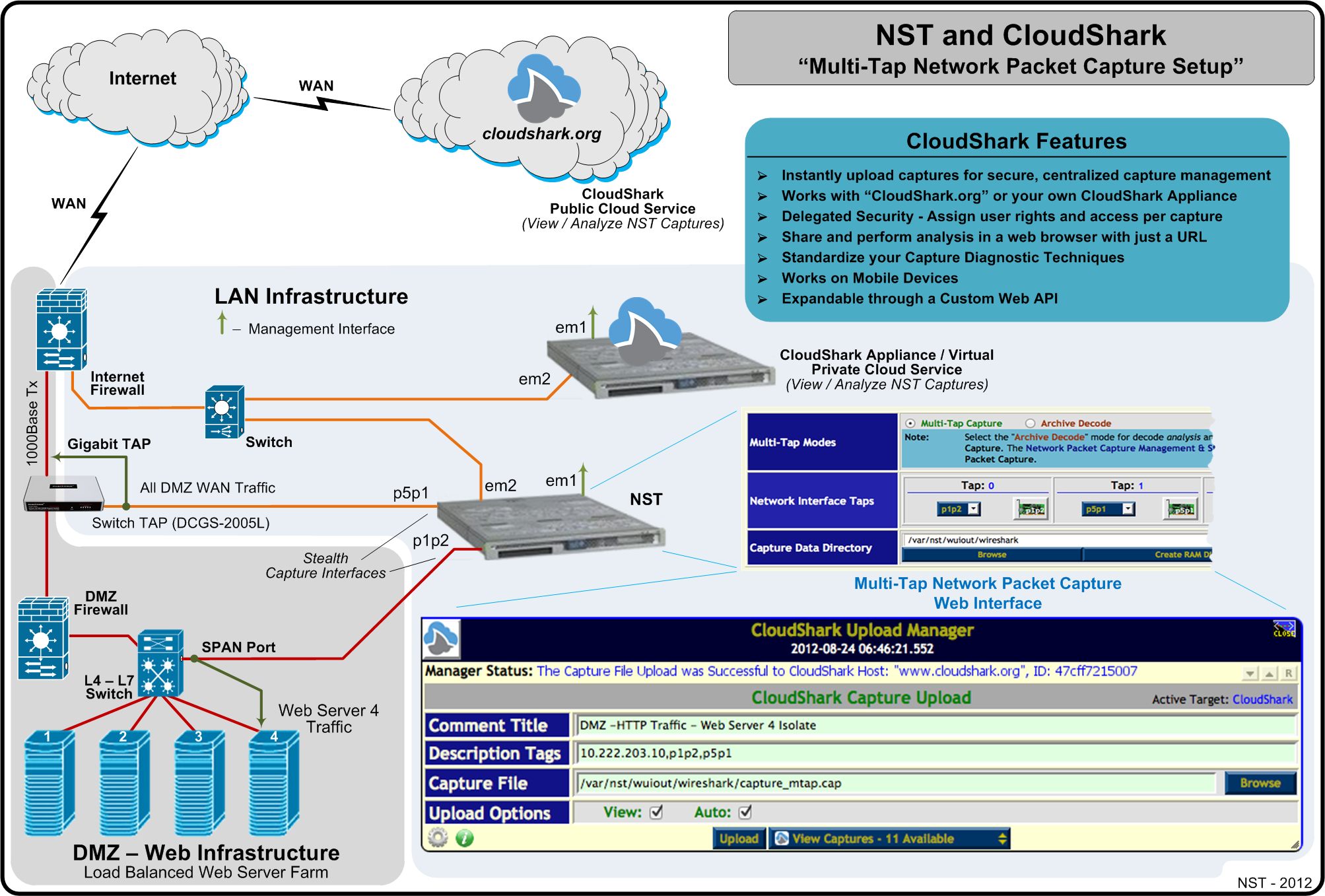
| 09:39, 10 September 2012 | Nst cloudshark multitap.png (file) |  |
728 KB | Rwh | NST & CloudShark - Multi-Tap Network Packet Capture Setup. | 1 |
| 08:27, 24 October 2015 | NETGEAR Whitepaper 10 Gigabit.pdf (file) |  |
720 KB | Rwh | NETGEAR 10 Things to know before deploying 10 Gigabit Ethernet. | 1 |
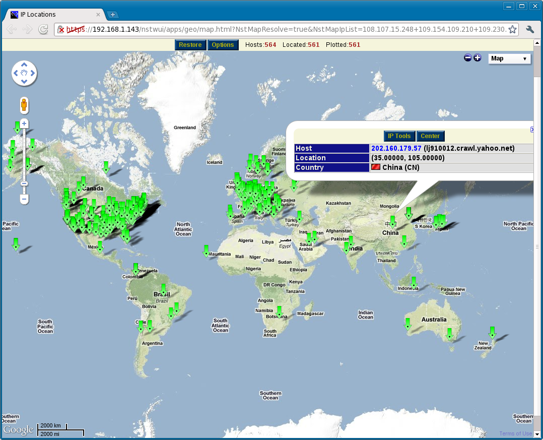
| 18:32, 3 May 2011 | Geoip-url-api.png (file) |  |
712 KB | Paul Blankenbaker | Rendering of 564 IPv4 addresses using the NST Geolocation URL API to show the hosts plotted on a interactive map within a browser. | 1 |
| 10:41, 14 October 2010 | Conversations wm zoom.png (file) |  |
705 KB | Rwh | IPv4 Address Conversations - Mercator World Map Zoomed in... | 1 |
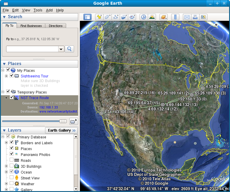
| 15:36, 17 September 2010 | Nsttraceroute-kansas.png (file) |  |
686 KB | Paul Blankenbaker | Viewing the results in Google Earth | 1 |
| 08:21, 19 September 2010 | Ntop-wm-hosts-tt.png (file) |  |
681 KB | Rwh | ntop Hosts World Map with DOM Tooltip Tip... | 1 |