HowTo Geolocate ntop Data
Overview
This HowTo explains the procedure for setting up an ntop session and producing on demand host geolocations rendered on either a Mercator World Map projection or on a KML Earth Browser such as Google Earth, Google Maps or Marble.
One of the goals of the NST WUI is to provide a web-based front-end to numerous open source network security applications. Trying to build out a web-based interface that has a common look-and-feel across the vast spectrum of applications is a daunting task. Once an NST WUI interface is mastered, it will become a routine task for the network security administrator to use it across different NST systems and network infrastructure environments.
Before diving into producing ntop Hosts Geolocations, one needs to understand best practices on how to setup an ntop session as a Host data source collector. This first involves getting ntop up and running using its NST WUI management interface and then secondly controlling how much data ntop is configured to collect using ntop administrative settings.
ntop Setup
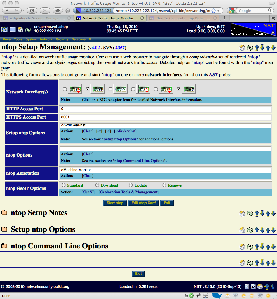
This section describes how to setup an ntop session using the NST WUI. The input and selection fields provided by the NST WUI management interface will be explained so that one can quickly start up ntop.
The image above depicts the NST WUI ntop setup management page. Use the following steps to setup an ntop session.
ntop Runtime Management
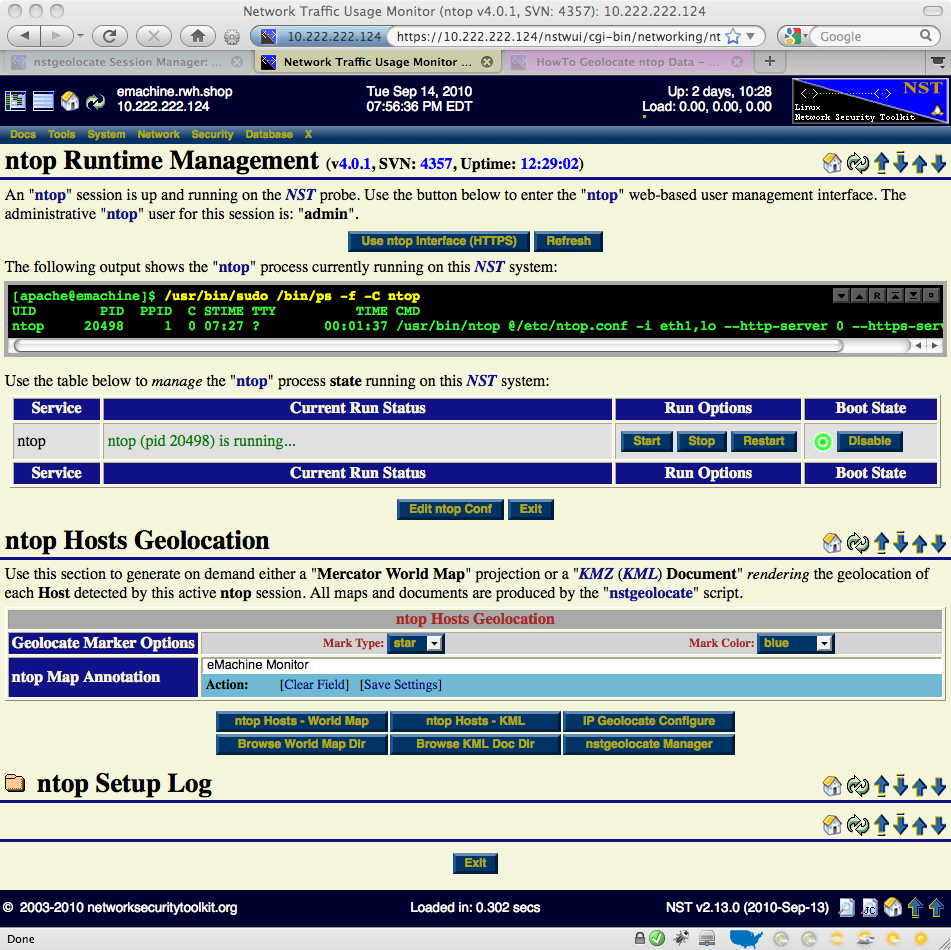
Once an ntop session is up and running, one can now produce on demand host geolocations.

